
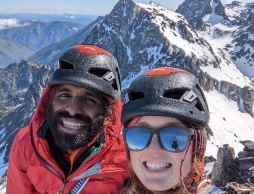
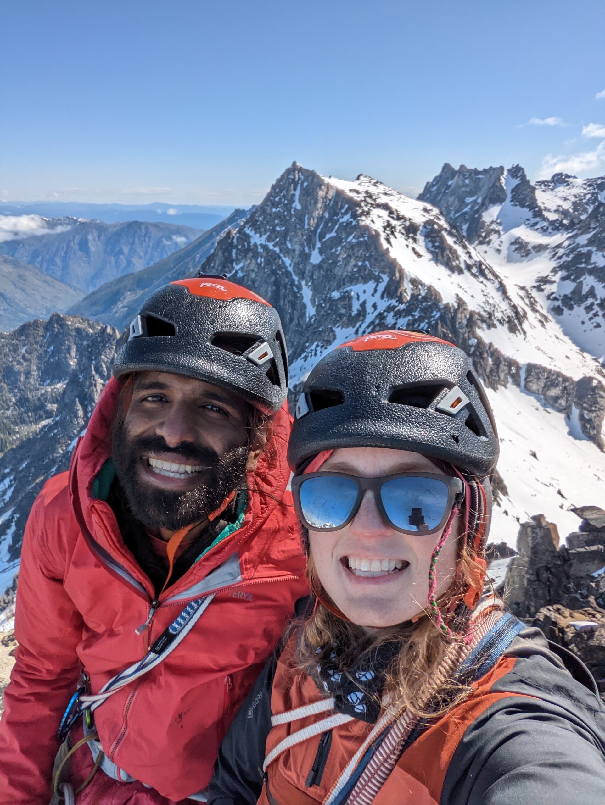
Guest climbing trip report from our Athlete Ambassador Shiv Gourshetty. Check out the details of his climb of Borah Peak!
Borah Peak – North Face Direct 11/2020
Mountain: Borah Peak
Route: North Face Direct
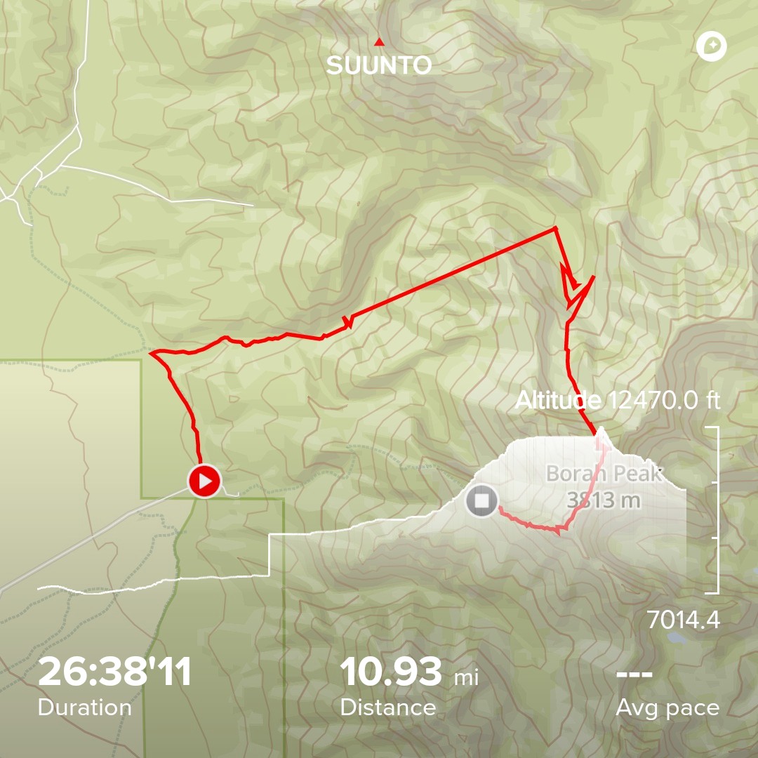
Total time: 33 hrs.
Summit Date: 2020, November 28
Elevation gain: ~7,270 ft
Highest Point: 12,667ft/ 3,861m
Over night: 0. Single push, 2 short bivy’s (1-2hrs)
Animal Sightings: None.
Trail conditions: Light fluffy snow- calf to thigh deep. Sunny, clear, cold crisp. Approximate -10F on the summit (conservative estimate, temps at parking lot were <3F). Meteorological winter has started few weeks before climb.
Approach:
High-level approach is to follow Rock Creek from TH to the North face basin. No trail so to speak, mostly bush whacking. For details read further, otherwise skip to ‘Ascent;.
We parked 2 miles away from the intended trailhead (TH) to facilitate shorter route on the descent. 15 mins down the street from Chicken Out Ridge (COR) TH. We walked our way through a lightly snowed dirt road to the North Face approach “TH”. 10 mins from the TH, there is a faint trail that crosses a small stream (Rock Creek). After crossing you go through heavy bushes to make your way on high slopes to the south of Rock Creek. Head-up, the heavy bush was manageable while the ground was frozen, but in summer or late fall assume this as marsh land for first 30-40 mins from TH. We encountered snow from here on, 2-3 inches to begin with.
Follow the creek crisscrossing 3-4 more times. Finally arriving at what is a waterfall in summer, was snowed in and dry upper section of Rock Creek. We crossed the snowy “waterfall” section half way up it and ditched the creek to ascend into the basin.
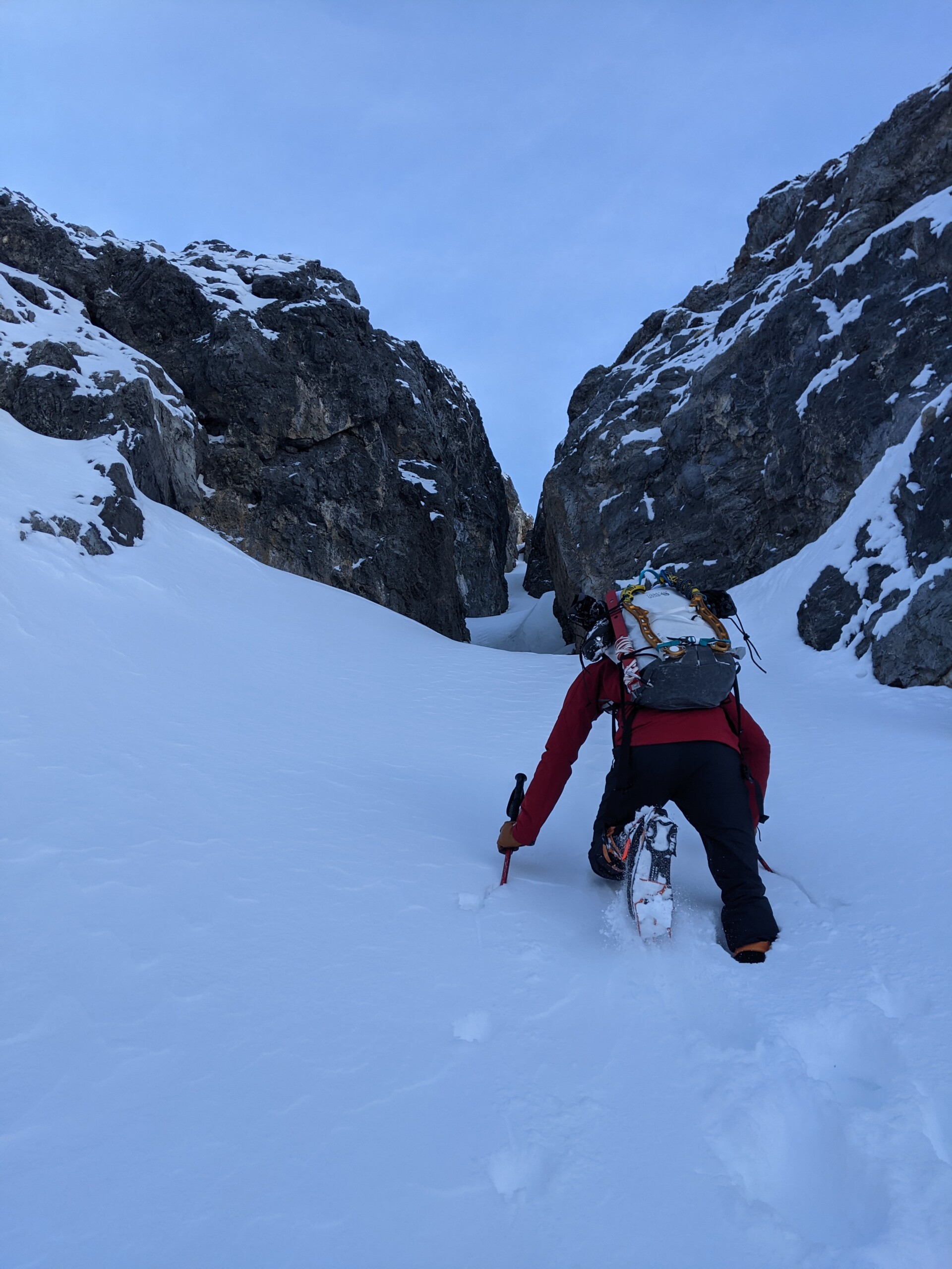
Reaching the rocky cliff bands would be the 1st section of approach at 9500ft. We climbed through a narrow snow couloir to bypass any rock scrambling in the cliffs. Parts of the couloir were 100cm deep post-holing, and snowshoes would have been heaven sent from here on for the rest of the climb. We did not anticipate winter like conditions.
From the top of the cliff bands, walk through low angle wind scoured rocky terrain. to the bottom of north face.
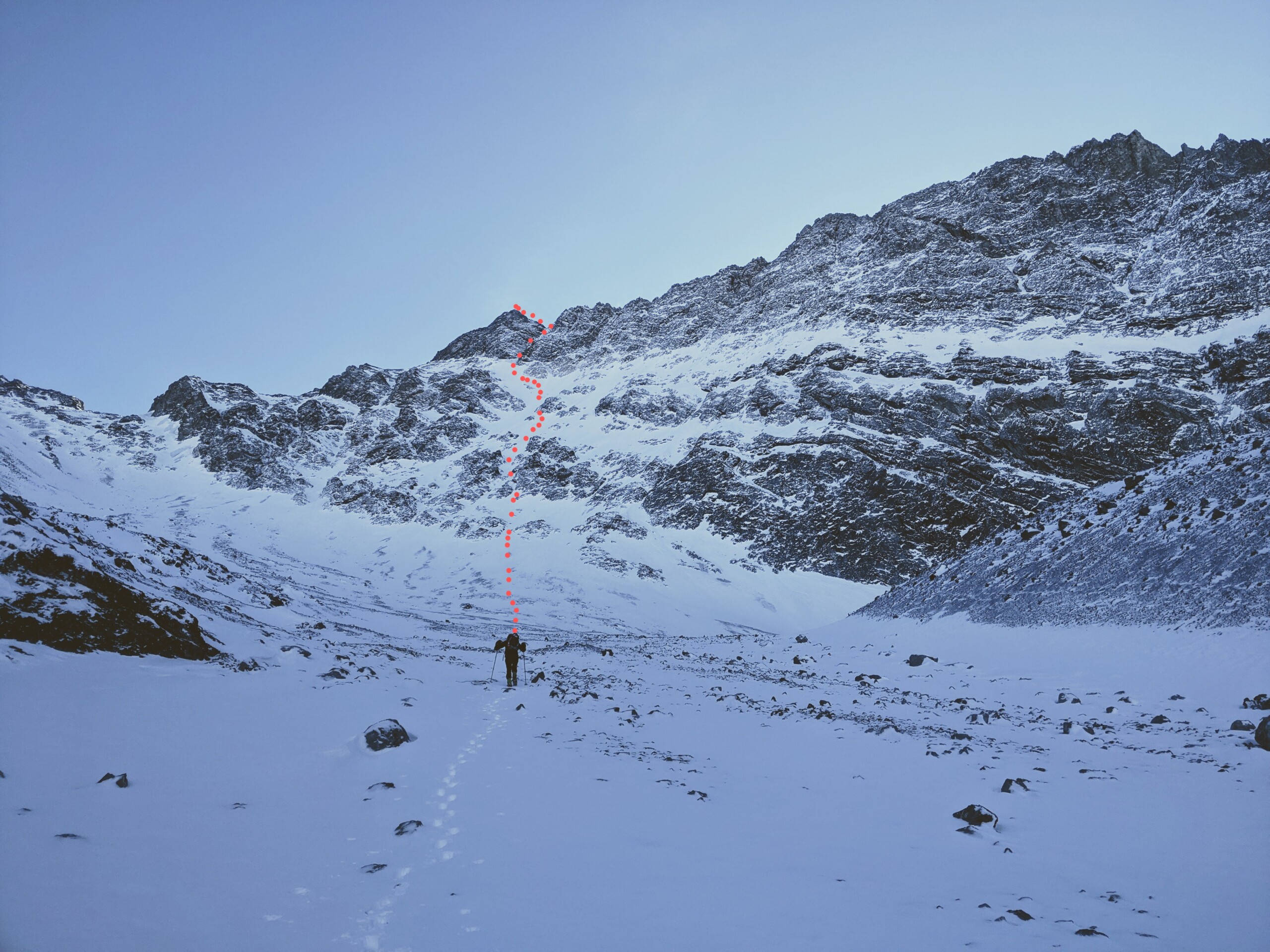
Ascent:
Pick the upper line of climb BEFORE climbing over the cliff band, lines become hidden behind several rock ribs once below the face. We picked a direct line up the face to the bottom of summit pyramid (~11am). The climb on the face was steep 50° slope, with knee-to-thigh deep light powder. Snow was in stable condition with no visible slides or other avalanche risks. The face is text book avalanche terrain and should be taken seriously.
Face climbing (~2PM) involved making our way through dryer rock parts hidden under snow. Shallow depths made for some unprotected and unexpected dry tool moves. Many ice gullies can be seen above along the NW Ridge and can be accessed. We continued to the ice gully we had picked from the basin before.
Once at the base of the ice gully (~5pm), we roped up and decided to simul-climb the route. Sun was close to setting with calm winds, hard ice with some snow accumulation on the rock walls lining the gully. After first few kicks and swings, I realized the ice was bullet hard, purchasing only a few centimeters depth for crampon teeth to grasp. I downclimbed and we decided to pitch out the route.
The 1st pitch was hard ice but easy going, except for a V4/ M5 boulder move in the middle of the pitch. With no way to protect the crumbly rock or the soft snow cover around the rock boulder it was an exposed overhang move, short one move wonder. Another half pitch up I setup ice screw anchors and brought Amanda up.
The second pitch was dubious in the dark, heading straight above or into an alternate right gully. Straight above clearly had no ice or snow, mostly dry tooling vertical wall, without daylight it was hard to tell if it can be protected. Right gully looked steep snow (70°) but where the gully leads to was unknown. We chose the right alternative.
2nd pitch is a mix of steep snow and narrow rock gully. Entry into the rock gully is gained after traversing right from the belay anchor, over a rock lip and then ascending straight. Neither the snow or the rock is confidence inspiring, snow was unconsolidated, and rock was crumbly. With delicate tool and crampon placement, dislodging only one rock boulder (close and scary call) I made it up to the ridge. A 3/4 rope length pitch with no protection. Brought Amanda up soon after (11pm).
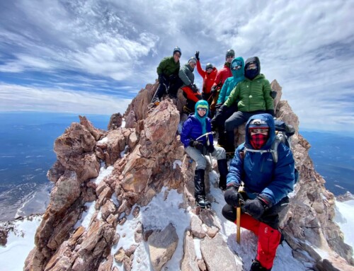
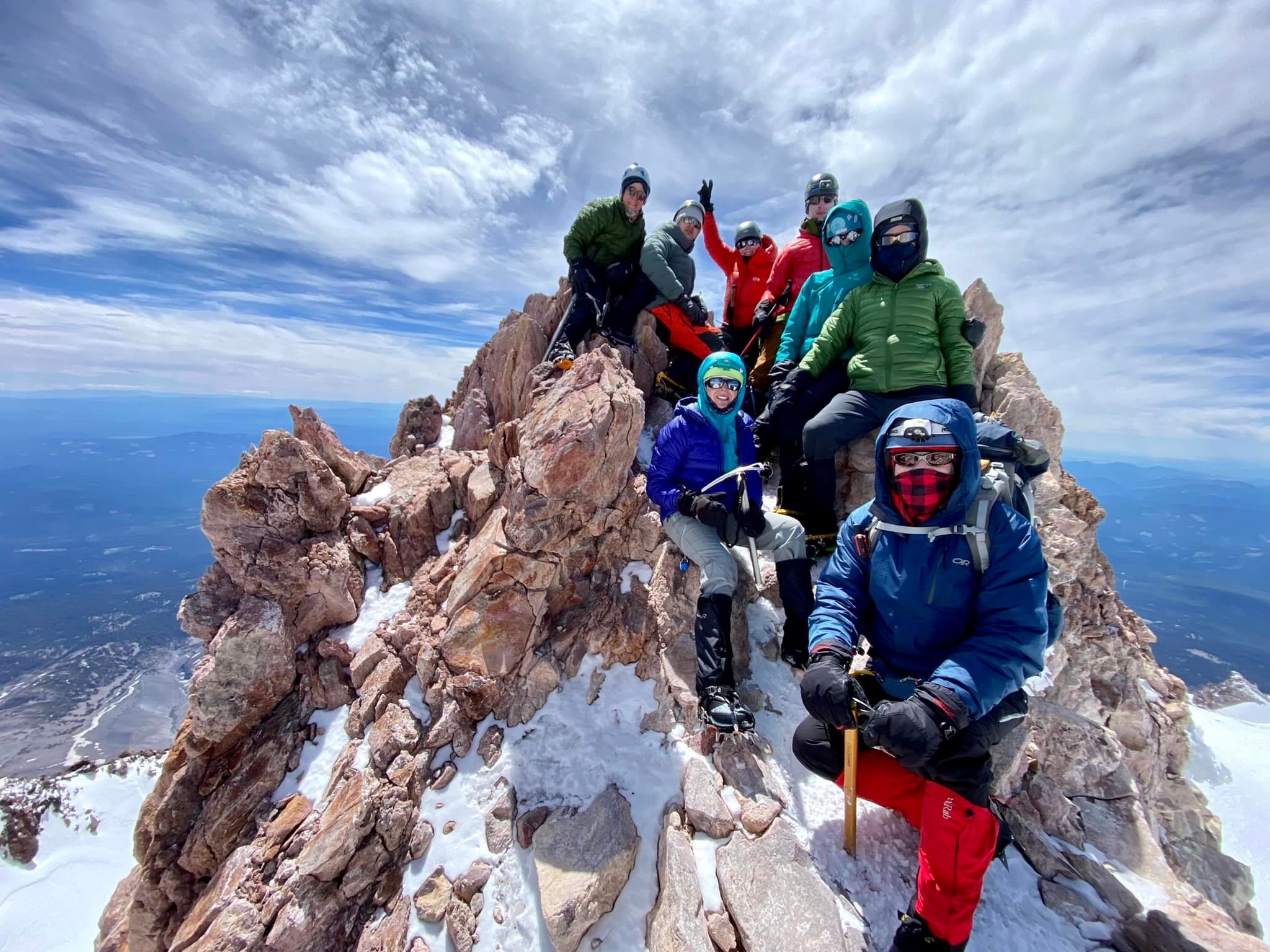
We setup a bivy on a small ledge on the ridge, refueled and took a nap. Mild gusts every now and then kept the temperature around -10F (conservative estimate). We woke up an hour later, packed up gear and rope. Full moon illuminated the route well. The ridge was tricky to navigate at night and buried in snow. Proper ridge looked dangerous to traverse due to cornice formation. We traversed onto the south face and looked for a path to the summit. Most of the ascent was on smooth rock with thin, 3-4 inch, snow cover with no possibility of protection. We both solo dry tooled a 50ft section, with a rather uncomfortable 2000ft exposure leading us back to the top of the NW ridge. From here, a small jaunt then another 50ft class5 scramble lead way to a false summit. Following the ridge for 150ft would reach us to the proper summit (~2am).
Descent:
We descended via the standard route, Chicken-out Ridge (COR). The route followed the ridge south then contoured around towards NW/ W. The route was fresh with 3ft unconsolidated which made descent a little slow. With no prior knowledge of the route or other footprints, route finding still consumed fair bit of time. Little less than half way through the ridge descent, snow levels reduced turning into mixed terrain, some exposed scrambling and steep descent. With tired legs and out of exposed terrain we decided to bivy until sunrise for another hour or 2, behind some rock boulders.
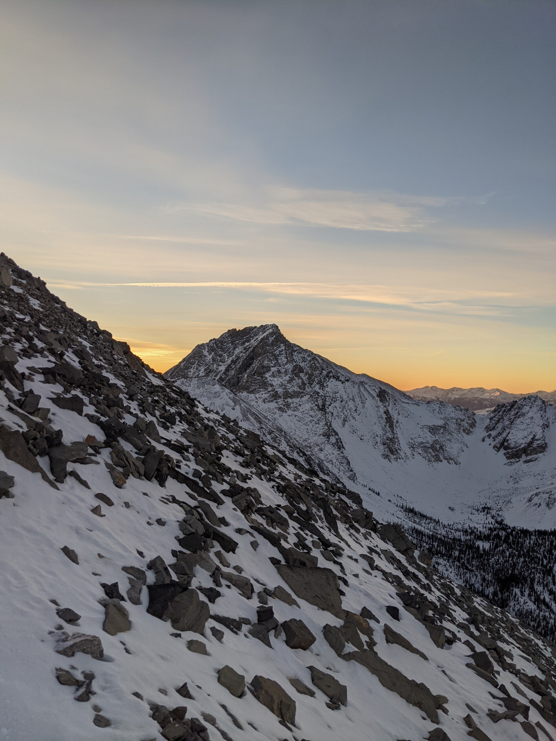
At sunrise (~8am) the entire valley dazzled with peaks illuminated by first light of dawn. We quickly packed the bivy and headed west following the ridge. Several animal footprints were observed but none to be seen in life form. No human presence was felt until all the way down to the van (~12pm).
Gear:
Ice Screws, set of offset nuts and pitons
Comment:
Borah is tallest peak in Idaho. Ideally this climb is better suited in Fall, avoiding all the snow on approach and descent only climbing ice. The ascent after the 1st pitch of technical climb might have been easier had there been day light to help navigate, its likely we accidently picked a harder route. Route tracked via watch is partially captured, as the watch died.